Independent community & visitor guide • Not affiliated with or operated by the City of East Liverpool
HERITAGE ON THE GROUND

East Liverpool’s Historical Marker Atlas

Meet the theaters, potters, travelers and surveyors whose stories live along these streets and nearby trails. Read each story here, examine its photograph and find its documented location.

Return to the city timeline →
HISTORICAL MARKER ATLAS

Stories beside your footsteps.

The marker network lets visitors discover theaters, hotels, pottery, highways, monuments and civic landmarks without needing to know what to search for.

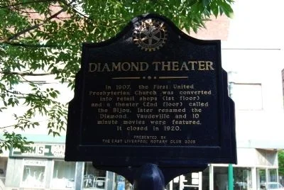
Diamond Theater historical marker, photographed July 3, 2011
Entertainment1907–early 20th century

Diamond Theater

A former church became a place for vaudeville and early movies, remembered by a marker near the Diamond.

Market Street at Fifth Street

Mike Wintermantel · photographed July 3, 2011 · Historical Marker Database
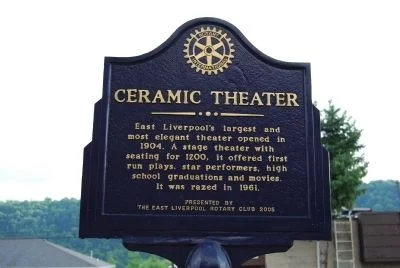
Ceramic Theater historical marker, photographed July 3, 2011
Entertainment1904–1961

Ceramic Theater

A vanished playhouse brought touring performers, graduations and movies into the pottery city’s daily life.

East Fourth Street near Market Street

Mike Wintermantel · photographed July 3, 2011 · Historical Marker Database
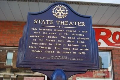
State Theater historical marker, photographed July 3, 2011
Entertainment1914–1970

State Theater

McKinley, Strand and State: one theater’s changing names trace the transition from vaudeville to the movie-house era.

St. Clair Avenue just north of Sixth Street

Mike Wintermantel · photographed July 3, 2011 · Historical Marker Database
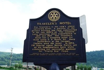
Traveler’s Hotel historical marker, photographed July 3, 2011
HospitalityLate 19th–20th century

Traveler’s Hotel

A historic hotel connects the city’s pottery trade, visiting performers and long-distance travel.

East Fourth Street near Market Street

Mike Wintermantel · photographed July 3, 2011 · Historical Marker Database
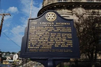
Lincoln Highway historical marker, photographed July 3, 2011
TransportationEarly 20th century

Lincoln Highway

East Liverpool’s streets were part of a coast-to-coast travel story that changed as road routes and bridges evolved.

Broadway near East Fifth Street

Mike Wintermantel · photographed July 3, 2011 · Historical Marker Database
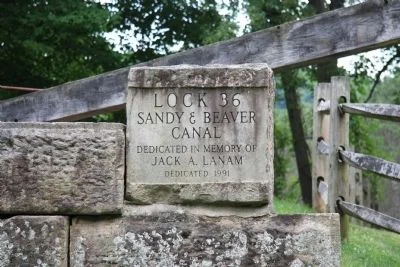
Lock 36 historical marker, photographed July 15, 2011
Canal history19th century · restored 1991

Lock 36

A restored canal lock makes the mechanics of moving freight through the creek valley visible.

Beaver Creek State Park, near Gaston’s Mill off Echo Dell Road

Dale K. Benington · photographed July 15, 2011 · Historical Marker Database
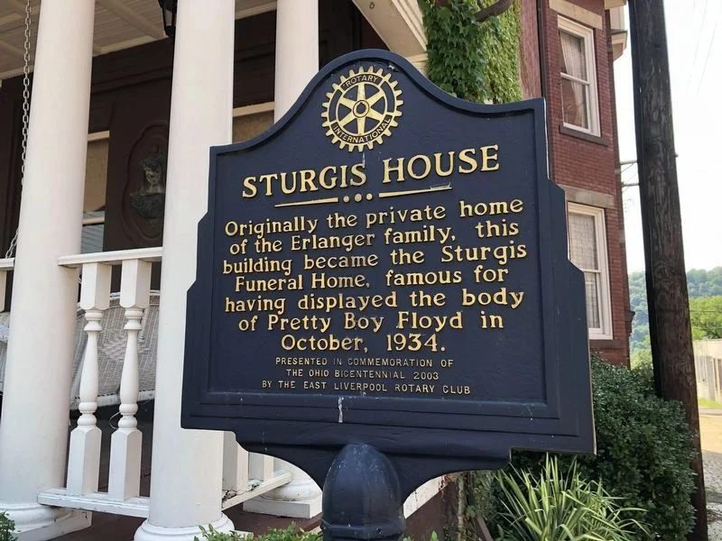
Sturgis House historical marker, photographed September 10, 2020
Architecture + people1934

Sturgis House

A former residence and funeral home became a local setting for the national story of Pretty Boy Floyd.

Peach Avenue at West Fifth Street

Devry Becker Jones (CC0) · photographed September 10, 2020 · Historical Marker Database
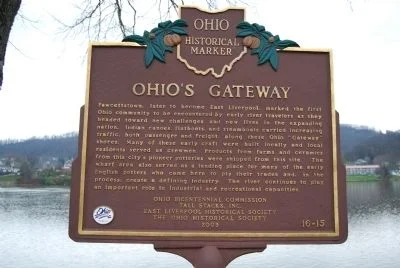
Ohio’s Gateway historical marker, photographed November 20, 2011
River historySettlement and river trade

Ohio’s Gateway

The riverfront tells a story of arrivals, freight and the people who shaped the pottery city.

Broadway Wharf, reached from Walnut Street

Mike Wintermantel · photographed November 20, 2011 · Historical Marker Database
Open the complete marker guide → · Follow the Heritage Trail →